.png?width=1563&height=1563&name=Untitled%20design%20(38).png)


.png?width=1563&height=1563&name=Untitled%20design%20(33).png)


.png?width=1563&height=1563&name=Untitled%20design%20(34).png)


Key challenges
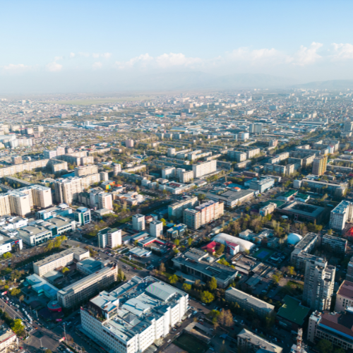
Geospatial organizations must turn vast, varied datasets into usable inputs for models that drive mapping, analysis, and decision-making:
Inconsistent data quality
Satellite, drone, and aerial data varies in resolution, completeness, and format.
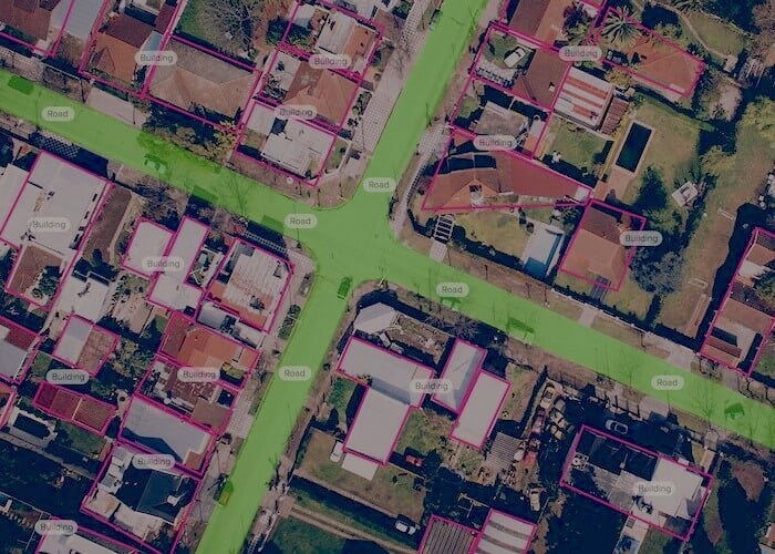
High labeling complexity
Object detection and classification across terrain, assets, and structures is nuanced and time-consuming.
Model bias & fairness
Lack of diverse data can lead to blind spots in geographic or demographic coverage.
Real-time analysis
Many use cases (disaster response, asset tracking) require rapid data processing and insight generation.
Key trends
Geospatial AI is reshaping how we analyze and interact with the physical world:
Remote sensing
AI extracts features from satellite and aerial imagery for environmental and land use insights.
Smart mapping
Models enhance accuracy and automate updating of maps and geodata.
Infrastructure monitoring
AI supports asset tracking and anomaly detection for utilities and cities.
Climate & disaster response
AI enables predictive models for weather, flooding, and fire risks.
Succeed with CloudFactory
CloudFactory helps geospatial leaders deliver AI that sees the world clearly—by making unstructured spatial data usable, supporting scalable labeling, and ensuring model quality across locations and tasks:
AI Consulting
We identify key geospatial workflows where AI delivers measurable value.
Data Engine
We clean, format, and label imagery and sensor data for mapping, segmentation, and detection tasks.
Training Engine
We tune models for specific regions, sensor types, or temporal variations.
Inference Engine
We monitor predictions for anomalies, bias, and accuracy drift.
AI Engine
We help operationalize AI systems that turn data into insight across physical landscapes.

Client Story: Allvision
Spatial AI innovator Allvision meets its ambitious smart city GTM mission 8x faster thanks to our flexible partnership.

.webp?width=1200&height=900&name=filters_quality(75).webp)
Client Story: Nearmap
A geospatial mapping company turned to CloudFactory for help to scale a new roof geometry business.
.png?width=500&height=500&name=Untitled%20design%20(24).png)
Transforming insurance assessments at scale: AI-powered geospatial solutions
Revolutionizing insurance with AI-driven geospatial solutions for efficient, scalable assessments. Discover cutting-edge innovation for insurers.