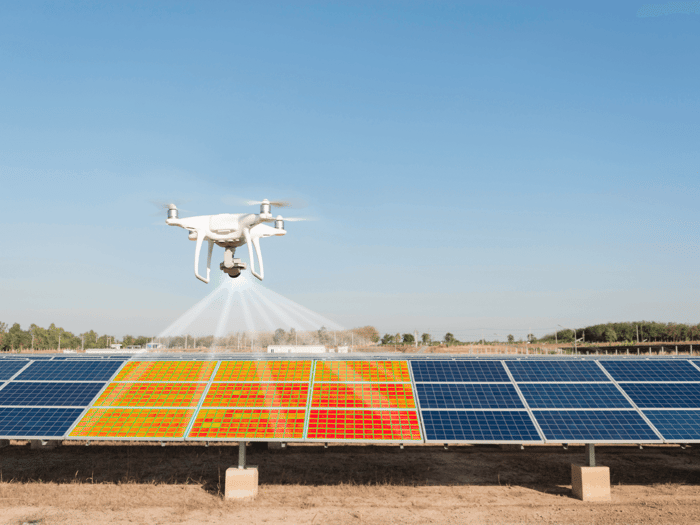
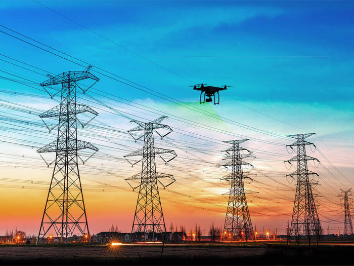
Aerial Inspection

CloudFactory's managed workforce prepares aerial inspection data so you can scale operations and improve asset management.

Overview

Whether you’re using satellites, aircraft, or drones for aerial inspections, the end result is a lot of data. Our managed workforce preps aerial inspection data for AI/ML, 3-D imaging, and digital twins so your team can gain valuable insights, reduce operational costs, and significantly improve the life of industrial assets.

Drones for Aerial Inspection

What We Offer

  • Teams with expertise in labeling 2-D and 3-D images and video, sensor, point cloud, orthomosaic, digital twin, and LiDAR data.
  • Skill at using all major image annotation tools—and the ability to quickly learn your in-house tools.
  • Experience in the utility, oil and gas, manufacturing, and civil infrastructure industries.
Teams with Expertise Labeling Data
— Meet Our Client

Enriching LineVision's 3-D data to improve utility asset management

3-D point cloud classification, digital twin creation

LineVision's non-contact sensor platform monitors transmission line asset behavior, detects anomalies, and issues real-time risk alerts. CloudFactory helps by:

  • Classifying 3-D point clouds of conductor positions, towers, and power lines to improve LineVision’s model.
  • Providing quality 3-D and sensor data to drive LineVision’s advanced analytics for electric utilities.
  • Creating digital twins for the real-time tracking of asset degradation levels.
Enriching LineVision's 3-D data to improve utility asset management
quote-icon

LineVision and CloudFactory are working together to help utilities reach a clean energy future, faster. We appreciate having a resource to focus on calibrating our data and making sure it's accurate. Our partnership has allowed us to accelerate that work.

Carson Casey

Carson Casey

Director of Marketing

LineVision and CloudFactory are working together to help utilities reach a clean energy future, faster

Ready to get started?

We’d love the opportunity to answer your questions or learn more about your project. Let us know how we can help.

How CloudFactory Works For You

Quality outputs

Quality Outputs

Because we focus intensely on delivering high-quality data to you, you can deliver higher-quality inspection data faster and at scale.

Agile Contracts

Agile Contracts

We offer flexible contracts so you can evolve your aerial data processing tasks without having to renegotiate contracts or change teams.

Expert Annotators

Expert Annotators

Maximize outcomes by using our best practices, gleaned from 10+ years working on complex annotations, including 3-D and point cloud.

Recommended Reading

Drone Inspection - Building a Scalable and Efficient Data Pipeline for Today and Tomorrow

Watch industry experts chat about how computer vision and AI, backed by high-quality data, is shaping the future of drone inspections.

Nearmap - Growing geospatial applications with quality training data

See how Nearmap scaled virtual tours across rooftops, buildings, and other location features by having CloudFactory take over data labeling.

Matterport - Creating interactive 3-D digital twins with image annotation

Discover how we helped Matterport’s in-house teams focus on development by classifying and labeling their vast spatial data library.

Talk to Sales